
.svg)



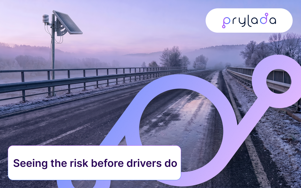
Winter hazards on the roads rarely give any warning. A bridge deck that was merely wet at midnight may be covered with a layer of ice by 4 a.m., while the road one kilometer ahead remains passable. For efficient infrastructure operators, the challenge lies not so much in anticipating the arrival of winter as in determining which section of the road is currently dangerous and whether a crew should already be on its way.
A road condition monitoring system is designed to solve precisely this problem.
What road condition monitoring actually means
Road condition monitoring involves continuously measuring weather and pavement parameters that determine how safe it is to drive on a given road. Instead of relying on periodic patrols, driver reports, or regional forecasts, operators receive real-time data from fixed points along the network and can observe changes as they happen.
In practice, this is a form of infrastructure monitoring that focuses on the road itself: its surface, the air directly above it, and the moisture between them. The result of this monitoring is not merely a set of numerical data on a dashboard. It serves as the basis for making decisions about where to dispatch de-icing crews, when to issue warnings, and how to allocate limited resources for winter road maintenance. This is precisely what makes it a key element of safety in road maintenance.
The role of environmental sensor systems
The foundation of any road condition monitoring system is a network of environmental sensors installed along the roadside. Environmental monitoring in this context typically involves several measurements: air temperature, pavement temperature (which can be lower than the air temperature, especially on elevated structures), humidity, and, in some systems, non-contact radar measurements of the surface condition. No single reading provides the full picture - a temperature just below freezing is harmless on a dry road but dangerous on a wet one. The value of an environmental sensor system lies in comparing these parameters over time.
Why black ice is the hardest case
Black ice is a thin, transparent layer that forms when moisture freezes on a cold surface, and drivers often don’t notice it until they drive over it. It usually appears at night or in the early morning, as well as after melted snow refreezes. Bridges, overpasses, and shaded areas are particularly prone to this phenomenon, since elevated structures cool down faster than roads at ground level.
Since it cannot always be directly measured as a physical layer, a reliable monitoring approach should focus on assessing the conditions under which ice is likely to form, rather than waiting for confirmation after the fact.
What the data says about the cost of late information
According to the U.S. Federal Highway Administration (FHWA), 24 percent of weather-related traffic accidents occur annually on snow-covered, slushy, or icy road surfaces, and as a result of these accidents, more than 1,300 people are killed and more than 116,800 are injured each year. The same FHWA report on snow and ice notes that winter road maintenance accounts for approximately 20 percent of state transportation department budgets, with state and local agencies spending more than $2.3 billion annually on snow and ice removal. The FHWA’s Road Weather Management Program estimates that adverse road weather conditions result in more than 1 million traffic accidents, 500,000 injuries, and 3,000 fatalities per year.
The most striking illustration of the cost of delayed information is found in the NTSB report on the investigation of the February 2021 crash on I-35W in Fort Worth, Texas, which ultimately involved 130 vehicles and resulted in six fatalities. The operator had pre-treated the overpass with brine 44 hours earlier—which, according to the NTSB, was a reasonable precaution. The problem lay in monitoring: crews relied on visual inspections and hand-held thermometers, and a patrol that passed by 45 minutes before the accident did not detect any ice. The NTSB concluded that environmental sensor stations located near the accident site could have provided the operator with the data needed to detect changes in a timely manner, and recommended that the state of Texas install such stations throughout the state, giving priority to bridges and overpasses. The operator later installed 18 sensors on elevated structures, spaced less than five miles apart, equipped with an automatic icing warning system.
From raw readings to a useful warning
A well-designed system makes it possible to distinguish valid alarm signals from interference. Prylada’s solution for black ice warning and detection combines data on air temperature, surface temperature, and humidity with data from a 60 GHz radar sensor and transmits it via NB-IoT to dashboards in the Prylada Cloud, a private cloud, or a local server. Alarm thresholds are configured to account for local climatic conditions and can be set so that a critical condition persists for a specific period of time, allowing short-term fluctuations to be filtered out. The device also switches between low- and high-frequency measurements depending on the risk level, which is important for battery-powered devices operating in automatic mode for extended periods.
In addition to these rules, machine learning is used: a deterministic model that recognizes patterns in sensor behavior to signal a high risk of icing even in cases where icing cannot be measured directly, as described in more detail in the section on how Prylada applies machine learning to monitor road surface conditions. When a risk is detected, alerts are sent via the control panel, SMS, or email.
The device behind the data
This entire system operates on the basis of the Prylada Ice Detection Point - a standalone roadside unit that combines sensors, an NB-IoT gateway, and a standalone power source (with an optional solar panel) into a single monitoring station, which collects and pre-processes data on-site before transmitting it. The service is provided under an “Equipment as a Service” model with a customizable contract term, which allows for a realistic pilot deployment of several stations on the most problematic sections before scaling up across the entire network.
Who should have monitoring on their stretch of road
Responsibility for winter road safety extends to more organizations than most people realize—the Fort Worth case involved a private concessionaire, not a government agency. This is significant for state and regional transportation agencies, municipalities, private road maintenance contractors, and toll road operators, which have contractual obligations to ensure safety, as well as for bridge and overpass managers and airport authorities responsible for runways and access roads. It is also important for organizations that use roads without owning them: freight and logistics companies, public transportation operators, emergency services, and insurers who assess risks.
It is worth noting the role of private operators: as part of the same investigation, the National Transportation Safety Board (NTSB) surveyed nine private and state-regulated toll road facilities and found that only three of them used any kind of road weather information system. For contractors who are evaluated based on safety and response time criteria, addressing this gap is both a safety measure and a way to demonstrate due diligence.
Beyond public roads: parking lots, hotels, and commercial sites
The same laws of physics apply wherever vehicles and pedestrians come into contact with cold, wet surfaces. Managers of shopping centers, office complexes, and parking lots can use the same monitoring systems to reduce the number of accidents in areas accessible to visitors, as can municipal urban planning departments responsible for sidewalks and crosswalks. The same logic applies to retail and business parks with large parking lots, logistics facilities with busy access roads, and hospitality properties such as hotels with access roads and guest parking lots, especially in regions with cold climates. For these operators, the motivation is often not only safety but also liability: property owners can be held liable for injuries caused by naturally forming ice if a hazardous surface remains untreated for an unreasonably long period of time. Knowing exactly when a surface becomes icy allows the facility manager to treat the necessary areas at the right time, rather than spreading salt across the entire property on a schedule or reacting only after someone has fallen.
Complementing what you already have
Most operators already have some road weather stations, and road condition monitoring does not have to replace them. Fixed stations rarely cover every bridge, shaded curve, or remote stretch, and conditions in those places can differ noticeably from the nearest station. Compact, wireless monitoring points can fill those gaps and give a more complete picture of the network. For more on how this fits into a broader seasonal strategy, see Prylada's article on winter maintenance and asset monitoring in harsh weather.
What to look for in a road condition monitoring system
When evaluating options, it’s worth asking a few questions: Does the system combine multiple parameters, or is it based on a single threshold? Can the alarm trigger logic be customized to account for climatic conditions and specific structures, such as bridges? How does the system respond to false alarms? Can it operate autonomously under conditions of limited power supply and cabling? And can the data be integrated into the systems you already use?
Road condition monitoring won’t eliminate winter risks, but it shifts the focus from reacting to incidents to taking proactive measures based on current conditions, and that’s precisely what often makes winter road maintenance safer and more effective.
.webp)